


Tuesday, Sep 08, 2026 10:45 [IST]
Last Update: Monday, Sep 07, 2026 17:45 [IST]


GANGTOK, :
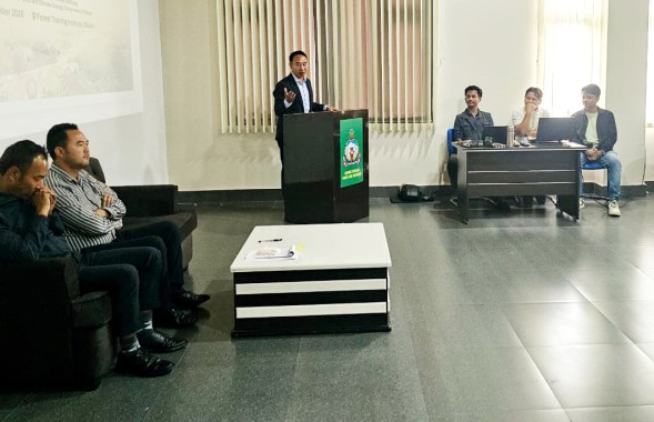
Forest Training Institute (FTI), Bulbuley, in collaboration with Balipara
Foundation, Assam, on Monday launched a three-day residential training
programme on geospatial tools for forest frontline staff in Sikkim.
The
programme, titled “Field to Map: Hands-on Geospatial Training on GPS & GIS
Software”, aims to strengthen the capacity of forest and environment department
personnel in biodiversity monitoring and management, the FTI said in a press
release.
The
inaugural session was chaired by FTI director Tshering Pintso Bhutia and
attended by experts and resource persons from the Balipara Foundation, FTI
officials, staff and participants.
Addressing
the gathering, Bhutia underlined the importance of geospatial technology in the
conservation, monitoring and management of biodiversity and natural resources.
He
urged the participants to actively engage in the training and make the most of
the programme.
The
three-day training will provide hands-on exposure to GPS handling and field
data collection, data transfer and spatial data visualisation using Google
Earth Pro and QGIS, the release said.
The
programme will also focus on improving the capacity of frontline personnel to
support decision-making through real-time monitoring of forests and
biodiversity using geospatial tools.
Forest
frontline staff play a key role in protecting ecosystems but often face
challenges in accurately documenting threats such as poaching and illegal
logging. Traditional methods, including handwritten notes and sketch maps, can
lack precision and consistency.
The
training seeks to address these challenges by equipping personnel with
practical skills to convert field observations into accurate, map-based digital
data, enabling better visualisation and communication of ground realities to
forest managers and policymakers.
Resource
persons at the programme include Balipara Foundation's programme lead for
research and developmentDr.BidyutSarania, wildlife researcher
Dr.PulakeswarBasumatary and GIS assistant Debajit Deka, Forestjoint director
and course coordinator Tenzing Norbu Bhutia and deputy director Anup J. Baniya.